 UttaraPedia
पुराने संग्रह से
Mussoorie
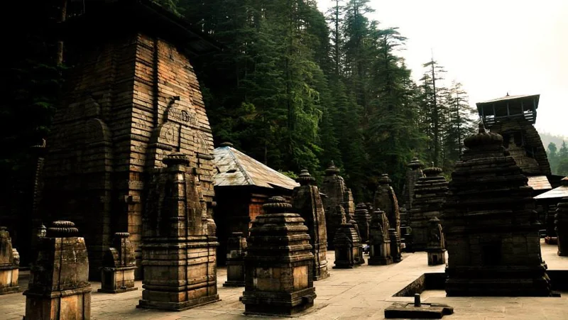
Photo credit
Uttarakhand collection · context photograph · PradeepBisht · CC BY-SA 4.0 · Resized, WebP conversion and display crop. Same license as original.secureutt · 2014-09-06
Mussoorie (Garhwali/Hindi: Masūrī) is a hill station and a municipal board in the Dehradun District of the northern Indian state of Uttarakhand. It is located about 35 km from the state capital of Dehradun and 290 km north from the national capital of New Delhi. This hill station, situated in the foothills of the Garhwal Himalayan ranges, is also known as the Queen of the Hills. The adjoining town of Landour, which includes a military cantonment, is considered part of 'greater Mussoorie', as are the townships of Barlowganj and Jharipani.
Being at an average altitude of 1,880 metres (6,170 ft), Mussoorie, with its green hills and varied flora and fauna, is a fascinating hill resort. Commanding snow ranges to the north-east, and glittering views of the Doon Valley and Shiwalik ranges in the south, the town was once said to present a 'fairyland' atmosphere to tourists.
The highest point is Lal Tibba with a height of over 2,290 metres (7,510 ft).In 1832, Mussourie was the intended terminus of the Great Survey of India that began at the southern tip of India. Although unsuccessful, the Surveyor General of India wanted to have the new office of the Survey of India based in Mussoorie. A compromise was to have it in Dehradun, where it still located.
By 1901 Mussoorie's population had grown to 6,461, rising to 15,000 in the summer season. Earlier, Mussoorie was approachable by road from Saharanpur, 58 miles (93 km) away. Accessibility became easier in 1900 with the railway coming to Dehradun, thus shortening the road trip to 21 miles (34 km).[1] Mussoorie view from the top of the hill (can be viewable while traveling on the way towards down of the hill) The name Mussoorie is often attributed to a derivation of 'mansoor', a shrub which is indigenous to the area. The town is in fact often referred to as 'Mansoori' by most Indians. The main promenade in Mussoorie is called, as in other hill stations, the Mall. In Mussoorie, the Mall stretches from Picture Palace at its eastern end to the Public Library (shortened to 'Library') at its western end. During the British Raj, signs on the Mall expressly stated: "Indians and Dogs Not Allowed"; racist signs of this type were commonplace in hill stations, which were founded 'by and for' the British. Motilal Nehru, the father of Jawaharlal Nehru, deliberately broke this rule every day whenever he was in Mussoorie, and would pay the fine. The Nehru family, including Nehru's daughter Indira (later Indira Gandhi) were frequent visitors to Mussoorie in the 1920s, 1930s and 1940s, and stayed at the Savoy Hotel. They also spent much time in nearby Dehradun, where Nehru's sister Vijayalakshmi Pandit ultimately settled full-time. During the 1959 Tibetan Rebellion, the Central Tibetan Administration of the 14th Dalai Lama was at first established in Mussoorie before being moved to its present location in Dharamsala, Himachal Pradesh. The first Tibetan school was established in Mussoorie in 1960. Tibetans settled mainly in Happy Valley in Mussoorie. Today, some 5,000 Tibetans live in Mussoorie. Now, Mussoorie suffers from overdevelopment of hotels and tourist lodges, given its relative proximity to Delhi, Ambala and Chandigarh, and has serious problems of garbage collection, water scarcity and parking shortages, especially during the summer tourist season. Landour, Jharipani and Barlowganj have fewer such problems.Geography and Climate
Mussoorie has an average elevation of about 2005.5 metres (6580 ft). The highest point is Lal Tibba, at a height of about 7500 ft (although the name Lal Tibba is now also used to describe a lovely lookout point, a short distance from the actual peak).
Accessibility
Mussoorie is conveniently connected by road to Delhi and major cities. It is called the "Gateway" to Yamunotri and Gangotri Shrines of Northern India. The closest rail station is Dehradun. Taxis are easily available for Mussorie as are buses at regular intervals.
The best time to visit is from mid-March to mid-November though torrential rain can be an inhibiting factor in the monsoon months of July to September.Tourism
Tourism is the most significant segment of Mussoorie's economy. It has a nature walk known as "Camel's Back Road". This road takes its name from a rocky outcrop in the shape of a camel's hump. Along the road, a cemetery is located about mid-way on the loop. There is also "Gun Hill" where a cannon was used to sound out midday for many years. Gun Hill is accessible by the cable car on the Mall road. The oldest Christian church in the Himalayas, St Mary's, is situated above Mall Road, and is currently undergoing restoration. Kempty Falls is a nice picnic spot. Company Garden is popular tourist destination. During season, the Company Garden has a vast collection of flowers and plants. Happy Valley has a small Tibetan temple. This was the first Tibetan temple built in India. The temple was constructed in 1960 by the Tibetan refugees. Lal Tibba is another tourist spot of Mussoorie. Picturesque Dhanaulti hill station is about 32 kilometres from Mussoorie. Mussoorie also had India's largest roller skating rink.
Nahata Estate
Previously known as "Childer's Lodge" is a huge property of more than 300 acres, owned by the Harakh Chand Nahata family. It is the highest peak of Mussoorie near Lal Tibba, it is situated at 5 km from the Tourist Office and one can go on horse back or on foot. The view of snow-clad mountains is exhilarating.GunHill
Second highest point of Mussoorie, at an altitude of 2024m located at 30.4953°N 78.0745°E